Burbing
The ideal route for any suburb in Victoria.
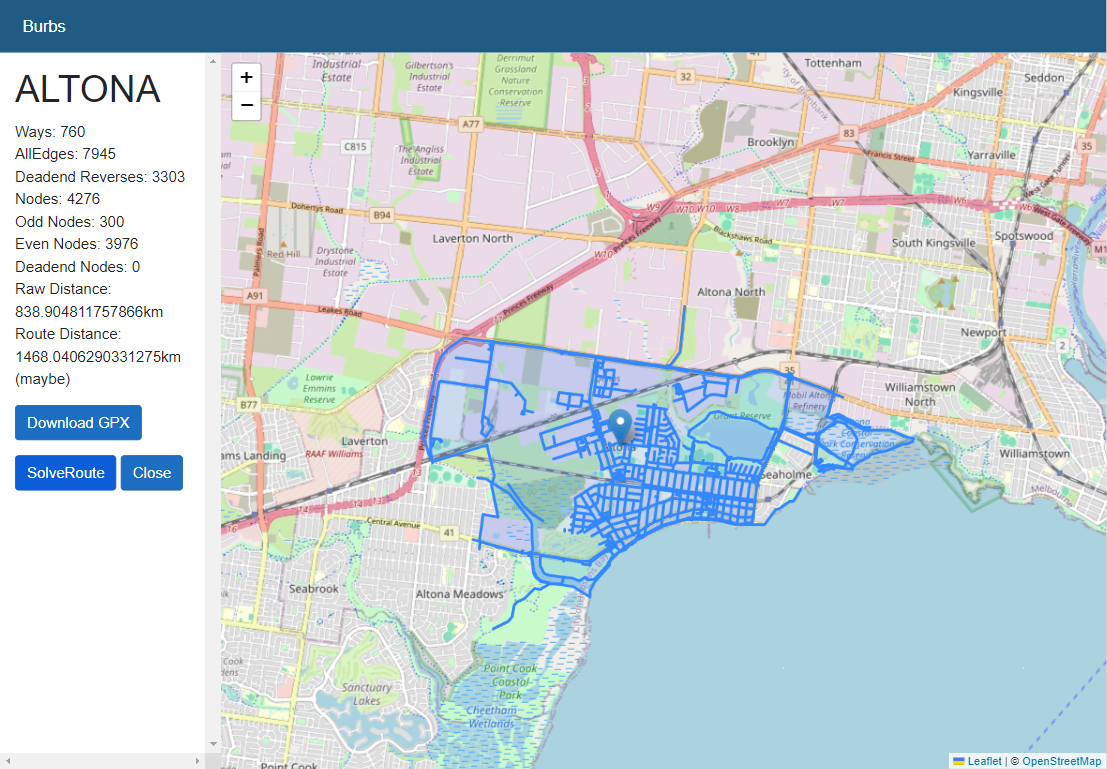
Cycling or walking every street in a suburb was all the buzz during lockdowns, but manually planning a route to cover every street was time consuming and finding out the ideal route is quite complex. I built a web app that loads every road in a suburb, plans the ideal route and exports it for navigation on a GPS.
Data
The data is collated from Australian Bureau of Statistics (ABS) open datasets and Open Street Maps using the Overpass API.
Route Optimisation
Finding an ideal route to cover every road is quite complex. Zhan’s Postie Problem(aka Route Inspection Problem/Chinese Postie Problem) was first described by Zhan in his PHD thesis. Many people have theorised solutions. My solution is based on a Fleury Walk, and uses Dikstra’s algorithm to find the ideal route.
The algorithm I’ve used here is heavily based on a python implementatiom by Mitch Leblanc https://github.com/supermitch/Chinese-Postman
User Interface
I’ve written this app using Blazor with the mapping component developed using Leaflet.